1779 Map and Survey |
| Back | Map Index | Village Centre | Long Street | Tathall End | Main Map |
Sarah Godfey is recorded as an owner of property in Hanslope parish in the 1779 survey.
The following is a section from the index to the 1779 map of Hanslope parish referring to SarahGodfey as an owner of property.
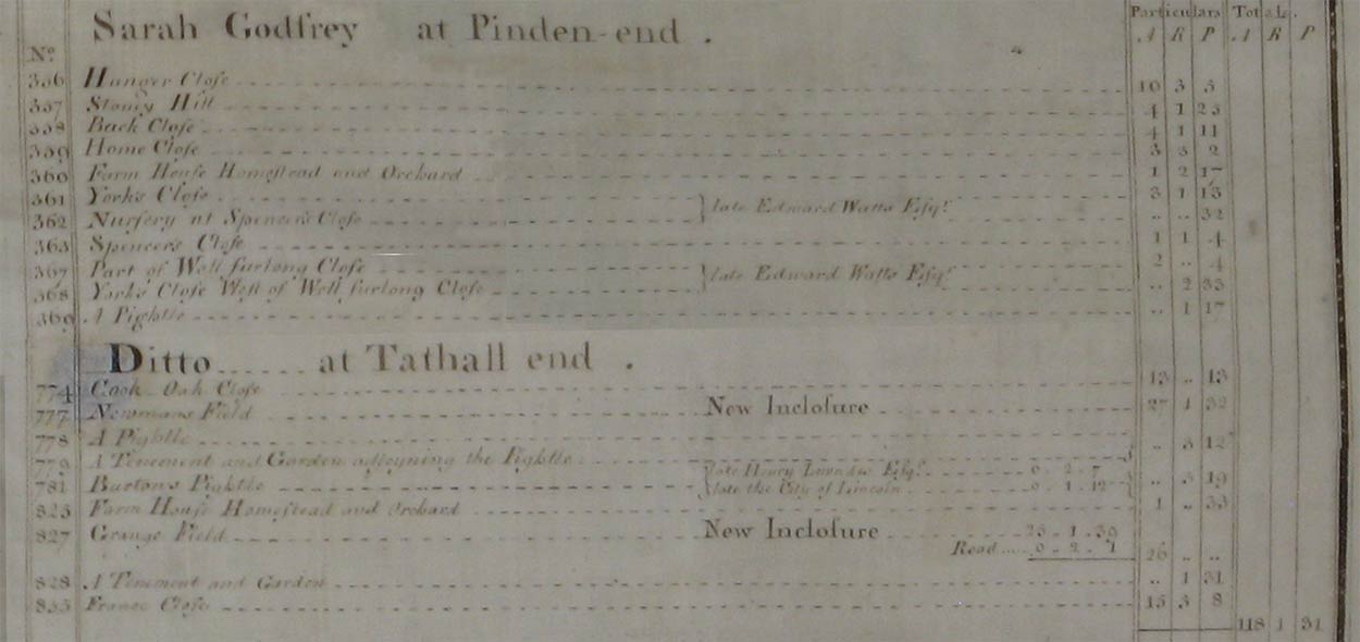 |
The following transcribes references above to houses and cottages.
| Owner | Ref.No. | Description | Building link | View Map Index |
| Sarah Godfey | 360 | Farm house, homestead and orchard | 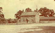 Chantry Farm |
|
| 779 | A tenement and garden adjoining the pightle | none | ||
| 825 | Farm house, homestead and orchard | 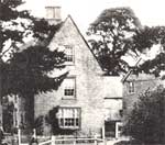 Tathall End Farm House |
||
| 828 | A tenement and garden | none |
|
Notes:
To view the page or index from the Survey referring to an entry above,
click on the For further information about buildings referred to, click on the building link. To locate the properties on the map, select either the
full map of the parish, or one of the extracts showing |
| Back | Home Page | Map Index | Village Centre | Long Street | Tathall End | Main Map |