| The survey was conducted shortly after the completion of the main 18th century enclosure in Hanslope and so depicts the new pattern of property ownership after the enclosures.
The Map
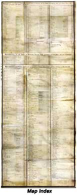
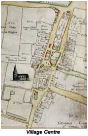
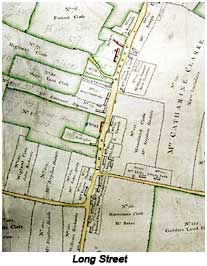
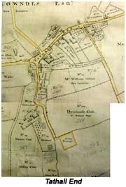
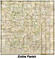 The map covers the whole parish of Hanslope. It is of very high quality and identifies and names every property and every field in the parish. An index in the bottom right corner of the map lists all properties by owner using a reference number for each item which appears on the map. The map covers the whole parish of Hanslope. It is of very high quality and identifies and names every property and every field in the parish. An index in the bottom right corner of the map lists all properties by owner using a reference number for each item which appears on the map.
The original map measures approximately 10 feet by 10 feet and seems to have been intended to hang on a wall. It was drawn on parchment mounted on linen. (Parchment is made from sheep skin.)
The map was prepared by Joseph Perks. Separate copies still exist which were prepared for Edward Watts and for the City of Lincoln, the leading landowners in the parish at the time. It seems possible that copies were prepared for other major landowners. There are subtle differences between the Watts and Lincoln copies, in that properties belonging to each landowner are coloured differently from other properties on their copy of the map (red for buildings, green for boundaries of fields, while properties not owned are coloured grey, and in the case of the Watts map, two shades of green are used to distinguish property "in settlement" from other property).
Measures of area on the map are in acres, roods and perch: 1 acre = 4 rood = 160 perch (1 rood = 40 perch). One acre is approximately 4,047 square meters.
The map shows that 43% of the land area in the parish was owned by Edward Watts. A further 25% was owned by major landowners (with land in other parishes), and a good deal of the rest was owned by people who do not appear to have been living in the parish.
|