1779 Map and Survey |
| Back | Map Index | Village Centre | Long Street | Tathall End | Main Map |
William Kitelee is recorded as an owner of property in Hanslope parish in the 1779 survey.
| Owner | Ref.No. | Description | Building link | View Map Index |
| William Kitelee | 481 | A farm house, homestead and home close | 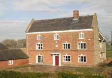 Hales Folly |
|
| 628 | A farm house, homestead and orchard | 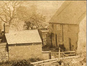 Town Yard, Gold Street |
||
| Comments in index: late William Crick | ||||
| 650 | Mr Kitelee's homestead and a tenement adjoyning | 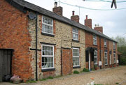 Caucutts Yard |
||
| 660 | Home Close | none | ||
| 661 | Three tenements and gardens adjoining | 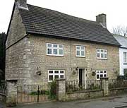 12 High Street |
||
|
Notes:
To view the page or index from the Survey referring to an entry above,
click on the For further information about buildings referred to, click on the building link. To locate the properties on the map, select either the
full map of the parish, or one of the extracts showing |
| Back | Home Page | Map Index | Village Centre | Long Street | Tathall End | Main Map |