1779 Map and Survey |
| Back | Map Index | Village Centre | Long Street | Tathall End | Main Map |
William Perry is recorded as an owner of property in Hanslope parish in the 1779 survey.
| Owner | Ref.No. | Description | Building link | View Map Index |
| William Perry | 644 | The Bull Homestead at Church-end | 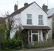 15 Gold Street |
|
| Transcriber's notes: marked on map at a different place to later Black Bull | ||||
| 644 | The Bull Homestead at Church-end | 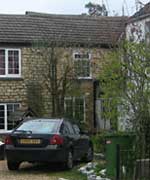 13 Gold Street |
||
| Transcriber's notes: marked on map at a different place to later Black Bull | ||||
| 646 | A homestead and small close at Church-end | 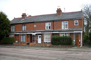 Peach View |
||
|
Notes:
To view the page or index from the Survey referring to an entry above,
click on the For further information about buildings referred to, click on the building link. To locate the properties on the map, select either the
full map of the parish, or one of the extracts showing |
| Back | Home Page | Map Index | Village Centre | Long Street | Tathall End | Main Map |