| Image Display |
|
| Back | Home Page | Images Introduction. | Images Selection |
|
| First image in set | Long Street | Last image in set | |||
 |
|||||
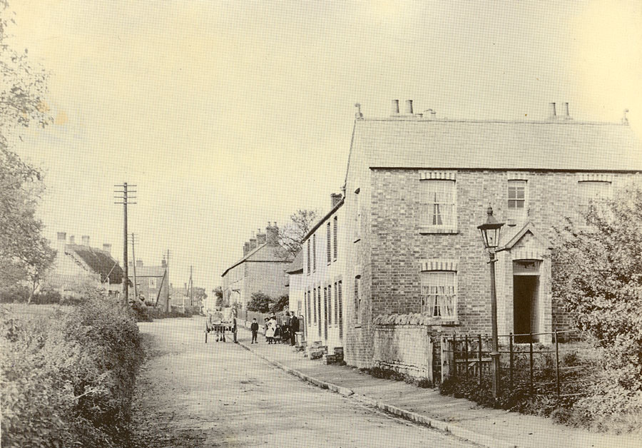
| A view of Long Street looking North, thought to date from the around 1900. The house on the right, now 2 Long Street, does not appear on the 1900 Ordnance Survey map, but is recorded in a survey in 1910. The thatched cottages on the left are thought to have been demolished around 1920 and replaced by houses in red brick. Beyond them is the house known as 'Redcot' which was demolished in the 1960s. | |||||
| Source: HDHS records, source uncertain | approximate year: 1900 | ||||
|
This image is included in the following additional sets:
(Click on set name to see thumbnails of images in set) |
|||||
| Back | Home Page | Images Introduction. | Images Selection |