| Image Display |
|
| Back | Images Introduction. | Images Selection |
| Building set: Black Bull, Gold Street |
|

|
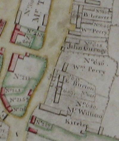
Part of Gold Street extracted from map of 1779 | Last image in set | |
 |
|||
| From a map of 1779. Shows land currently occupied by Black Bull as owned by John Gurney (No 645 on map). Note that on the key on this map, the next plot along, no.644 in the name of Wm.Perry is described as "The Bull Homestead". To view the entire map, follow link below for John Gurney. | |||
| Source: HDHS archive | year: 1779 | ||
|
This image is included in the following additional sets:
|
|||
| Back | Home Page | Images Introduction. | Images Selection |