|
From a map of 1818
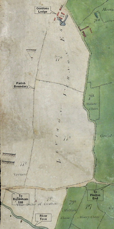
Gordons Lodge and the parish (and county) boundary are indicated by call-out boxes overlaid on the map. The river Tove and the road from Bozenham Mill to Pindon End are also indicated. It appears Gordons Lodge was access from a track running from this road.
In this map all land owned by Edward Watts is shaded green. The two fields belonging to Gordons Lodge which fall within Hanslope Parish are clearly shown in grey, and the owner in 1818 is indicated as Levison Vernon.
To view the entire map from which this fragment is taken click on map
|